(See Part One of this adventure here.)

The unfortunate have filed from the lottery room leaving the winners to celebrate.
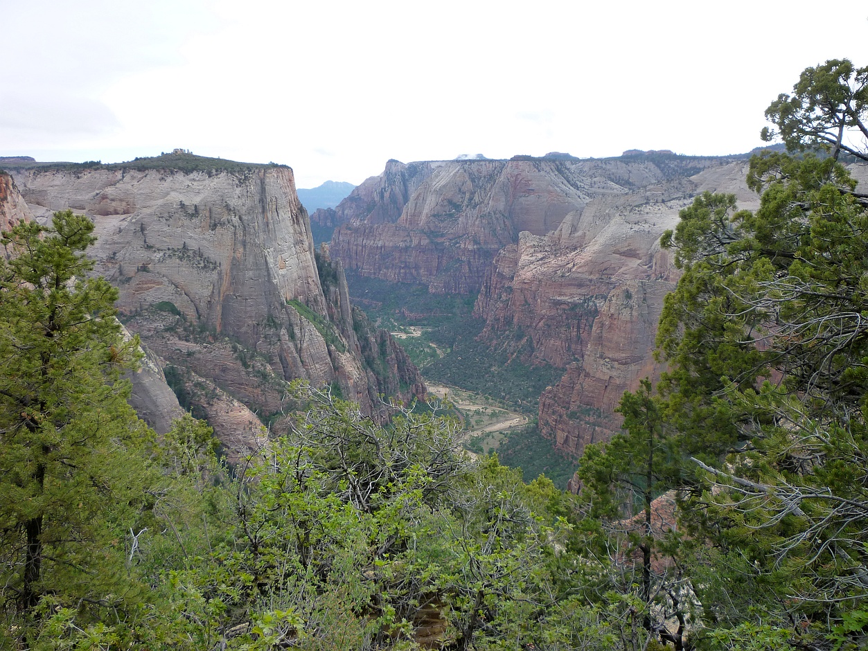
Having yesterday won the right for today’s hike into “The Wave”, we awoke still lauding our good fortune. From yesterday’s misstep, we could see how easy it would be to get lost for a few hours on a hot afternoon, and run out of water. People die on this hike. Taking the ranger’s advice to heart, we had the “10 essentials,” including almost a gallon of water each, a compass, and a couple of copies of the BLM map. The map shows compass bearings at half a dozen points along the way, as well as photographs taken from each point. Much of the path is unmarked and over bare rock, so it’s important to navigate by the suggested landmarks. Along the way, the route passes from Utah into Arizona, but there’s no sign marking the border.

Near the trailhead en route to The Wave. They can always find me from the air with that shirt!
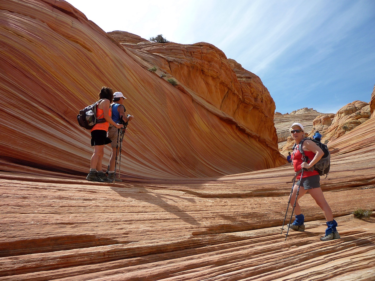
We had a nine AM start from the parking lot that served the North Coyote Buttes. The May air was still brisk, but the sun was already hot. The directions were good, and we had little trouble staying on target for “The Wave”, about 90 minutes distant. From most of the high points along the route, you can see the distinctive cleft in the rocks above the destination. During wetter times, this cleft is apparently a waterfall. It didn’t hurt that Darcy had been there five years before – Marty had unfortunately been Number 11 that day.

This is what much of the route to The Wave looks like.
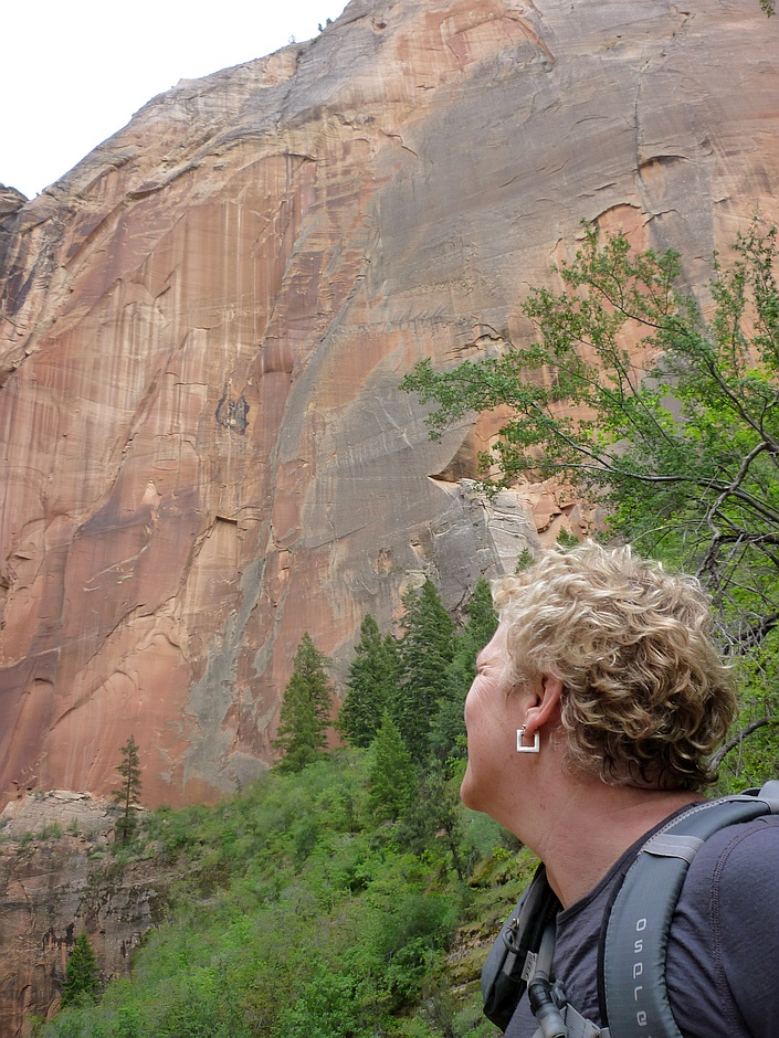
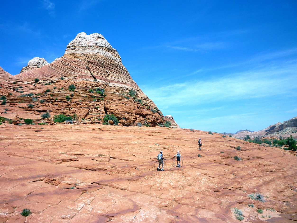
The desert landscape is surreal. The colors of the hills range through every shade of red, yellow and brown. The shapes are equally striking: one set of hills resembled either a row of giant Hershey’s Kisses or perhaps mega-dinosaur coprolites. Although we didn’t see any, there are signs of dinosaurs in the Jurassic era rocks. Looking down, we could see hundreds of fossils; they resemble ancient brain corals, but are probably be something else entirely. In the few areas they could get a foothold, wildflowers were in bloom in pink, yellow, and lavender.

Wild lavender grows in a patch of sand showing tracks from the past day or two’s hikes. The wind will erase them.
Suddenly, we were there.
Suddenly, without warning, we’re at the entrance to The Wave.
It’s impossible to do “The Wave” justice with either words or pictures. Being in the middle of it is magical. It’s a small smooth-sided twisty gully with undulating stripes of shades of yellow and ochre. By leaving early, we arrived at “The Wave” before the majority of the day’s twenty hikers. Of this we were glad, as being there alone enhanced the visual experience. By the time we left, there were about a dozen people wandering around the area, and it felt almost crowded. But there was a certain camaraderie amongst the lucky few allowed in.

Cheryl stands in one of the side channels to The Wave’s main gully.
After eating a quiet lunch while taking in The View – eyed by a cautious raven – we spent an hour or so exploring the area above “The Wave”. While not as stunning as the gully itself, there are plenty of interesting features within a few hundred yards. We were surprised to see a number of small pools of water nearby, and even more surprised to see they were teaming with tadpoles, insect larva, fairy shrimp, and even a few small fishes. We could only imagine that the water table below the now-dry waterfall was sufficiently near the surface to prevent the ponds drying up within hours in the hot sun.

Teaming with life, a pool of standing water just above The Wave. The water is very likely brine.
This water is apparently a remnant of the history of the formation. The gully was originally carved out by streams that cascaded down from the cliffs above, but in more recent time, the watercourse has shifted, and the gully has been sculpted by the prevailing winds. During our lunch, there was a good breeze blowing through it. The layered rocks themselves are sandstone laid down over 150 million years ago. At that time, this area was the center of an enormous equatorial desert of reddish sand. Much later, water leaching through the rocks would sometimes bleach iron from alternate layers, resulting in the dramatic stripes.

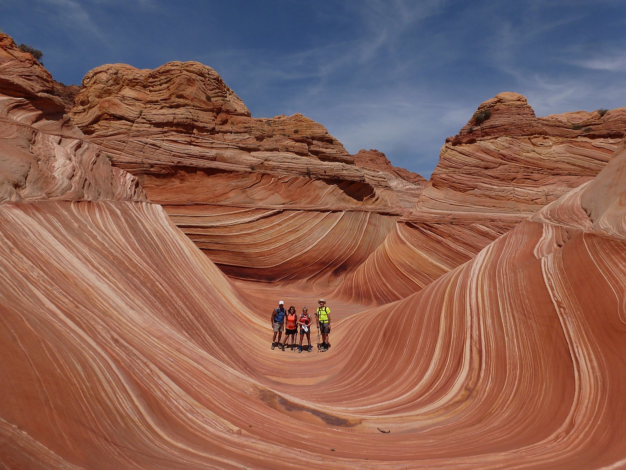
Our companions and we standing in the main part of The Wave.
Heading back required a similar process using waypoints and compass bearings. The BLM map included photographs and readings for the return journey as well. One would think that retracing one’s steps would be easy, but it’s good not to get too cocky when close to home. The ranger had told us yesterday that more people got off the path on the return journey, especially where the path veers left to go over the saddle near the end of Coyote Buttes. Veering too soon could lead us into a steeper descent than we’d like. Veering too late could have us down in the lowlands where it would be harder to orient ourselves. Or even lead us to the sheer edge of Buckskin Gulch, which would present challenges of its own.
Beginning the trek back from The Wave, distracted by visions of cold beer and nachos at Escobar’s.
Sure enough, as we headed up the hill, we began to disagree about the exact route. It’s interesting to see how the brain starts to see patterns and resemblances wherever it looks, and soon each of us was sure of the correct saddle – except there were at least three of them. Soon, two other couples caught up to us and added to the disagreement. I was quite convinced we had gone past the correct saddle, while others thought we needed to go farther still. Six of us eventually continued up the route we were following, and the other two opted for another route. None of us were too concerned about getting lost as we could see the large limestone hills that we knew to be behind the parking lot. Still we knew we could easily spend a couple of hours wandering around in the growing heat.

A reminder that not everyone survives out here in the desert.
As we came down the other side, it was clear we had not returned by the same saddle we’d come up. However, by following to the left the small wash at the base of the hill, we soon got back to the trail, which is clear enough at that point. The rest of the trip back to the car was uneventful. But even in hindsight, I doubt we four could all agree on exactly by which route we’d returned.
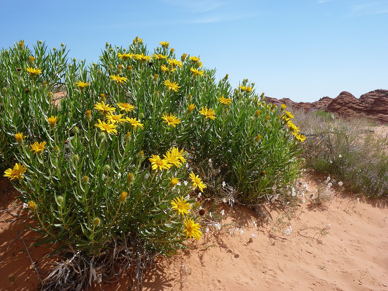
Away from the bare rock, more desert flowers blooming in mid-May.
As we left the parking lot, we passed the ranger coming in for the afternoon. Since each car needs to display a copy of its permit, there would be a good indication of who had not returned by nightfall, and in what area they would be. So if you get lost, someone might come looking. However, if you don’t feel comfortable with that possibility, it’s recommended to hire a guide for the hike. And take lots of water.
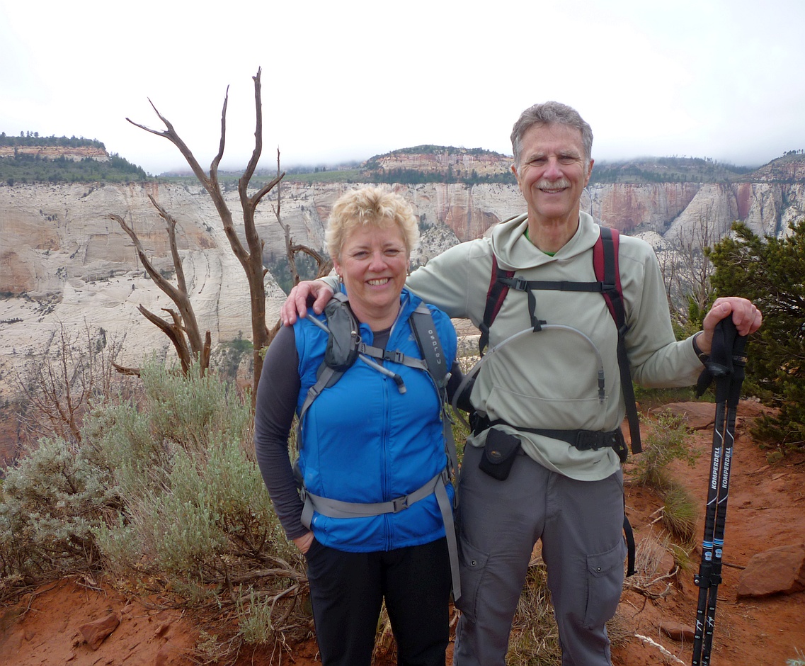
Celebrating our luck in winning the chance to hike into The Wave in Arizona.
At the end of the day, we still felt incredibly lucky to have won the lottery to visit “The Wave.” With our chances having been about one in twenty, we hadn’t really expected this outcome. We heard a rumour that if you fail to win a spot, and return to try again each subsequent day, you will be awarded an additional ball each day, up to a maximum of five balls. That would probably give you a fifty-fifty chance of getting in by the fifth day. However, I was not able to find a reference to this online. Another option is to enter the online lottery for one of the other ten spots, something you need to do several months in advance. Good luck!

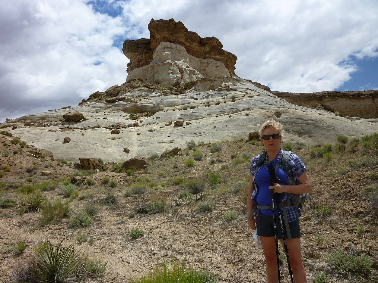
Cheryl posing in front of the unforgiving terrain that guards The Wave.
On the way back through Las Vegas airport, I finally got to try my luck at the slot machines. Gambled and lost a dollar and that was enough for me! I guess I’d used up all my luck in Kanab.
Notes in the Margin:
A few days before our trip, we received an unusual request through the Couchsurfing site. A young couple in Poland were getting married, and the bride’s brother was creating a video with best wishes from all over the world. We offered to send our greetings from our home town, but thought it would be a nice touch to send personal greetings from Zion and “The Wave” as well. So we had some extra fun putting those together on the hikes.

What?! I knew I should have bet on 13.
Related Posts:
- Lucky 13 Wins in Vegas, … er, … Kanab, Utah
- Adventures in Our Back Yard
- Couchsurfing on a Feather Duvet
For More Information:
- Kanab Visitor Center (Bureau of Land Management)
- Coyote Buttes Permit System at the BLM (for “The Wave”)
- How to Obtain a Permit
- Applying for a Permit Online (four months in advance)
- “The 10 Essentials for the Backcountry” (REI) – yes, we had them all
- “Trouble in North Coyote Buttes” (from a hiker who got off track on the way back)
- “‘The Wave’ on Utah-Arizona border claims the third life this month” (LA Times, July 2013)
- List of Authorized Guides (BLM)
- The Wave featured in “22 Pictures of Natural Marvels You Have to See to Believe” (BLT)
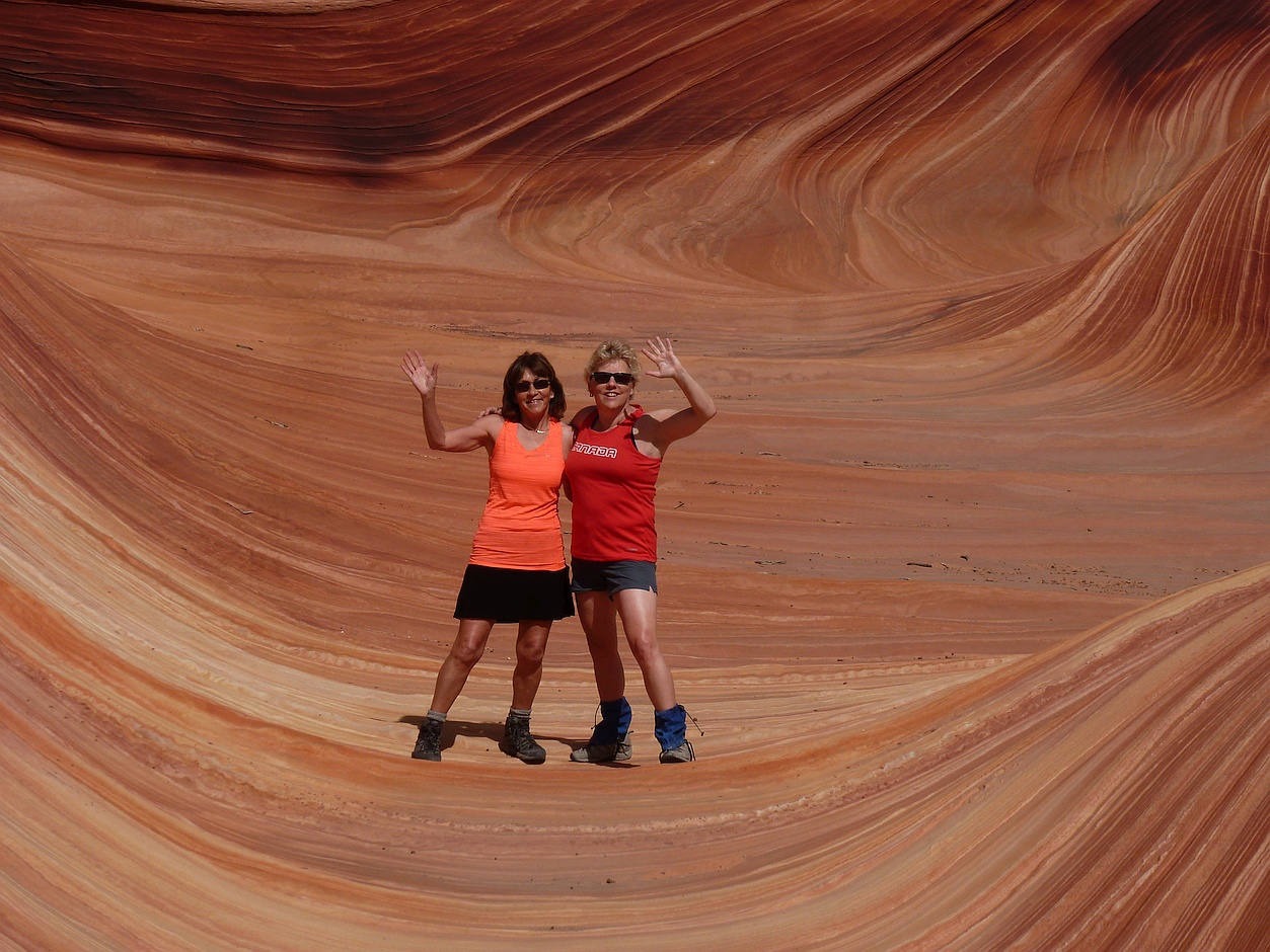
Waving from The Wave – all the way to a Polish wedding!