Tag Archives: Recreation

Kedging for Fun and Non-profits

In sailing terms, kedging is the process of moving a ship forward by sending an anchor out ahead of it, and then pulling the ship forward by hauling on the anchor. This slow and laborious process can be repeated indefinitely.

“Younger Next Year: Live Strong, Fit, and Sexy – Until You’re 80 and Beyond”

As the book “Younger Next Year” explains, the same process can be used to pull yourself through the slow and laborious process of a daily exercise regime. The idea is to set a physical stretch goal that will keep you moving forward when the couch is softly calling.

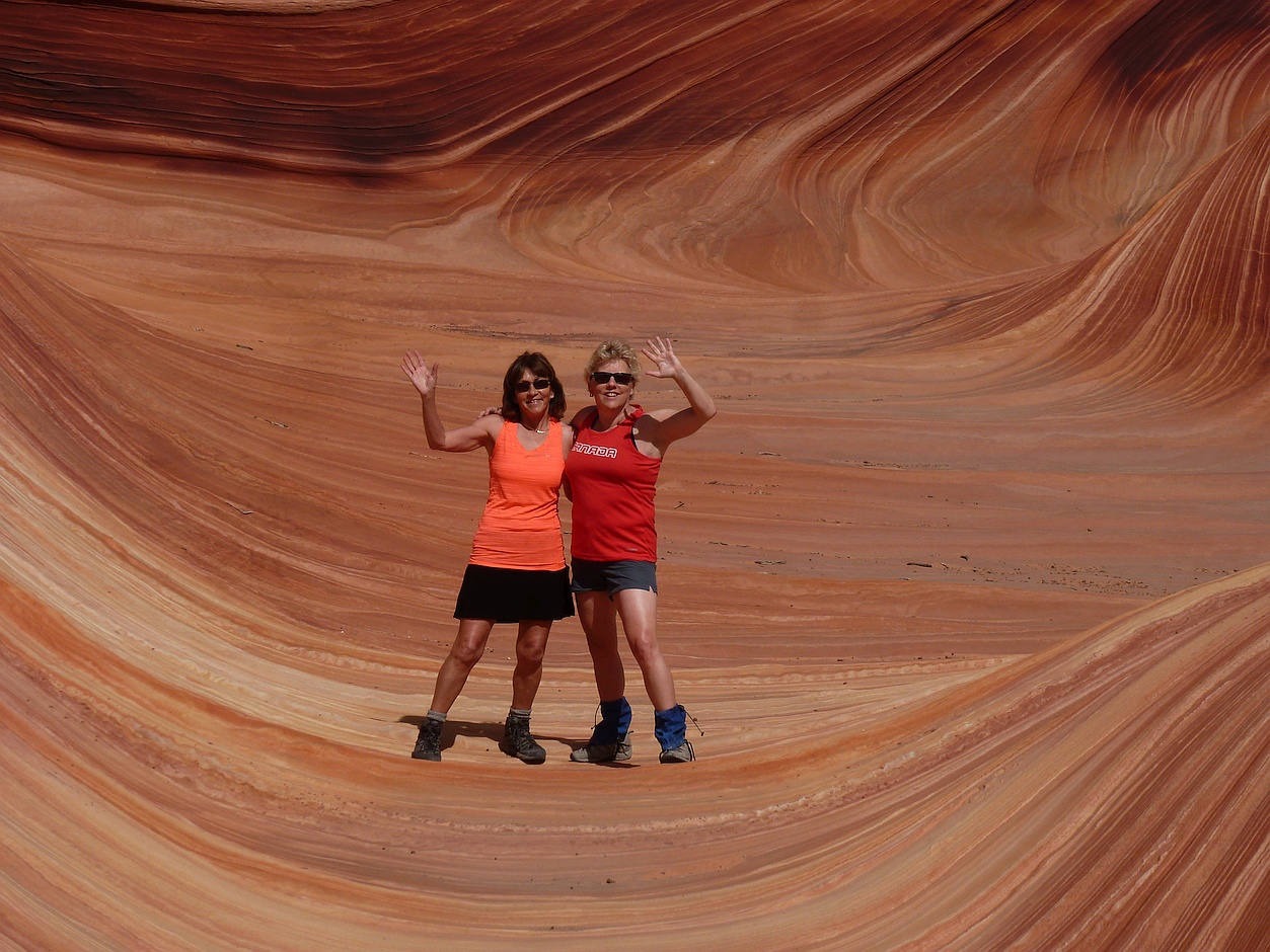
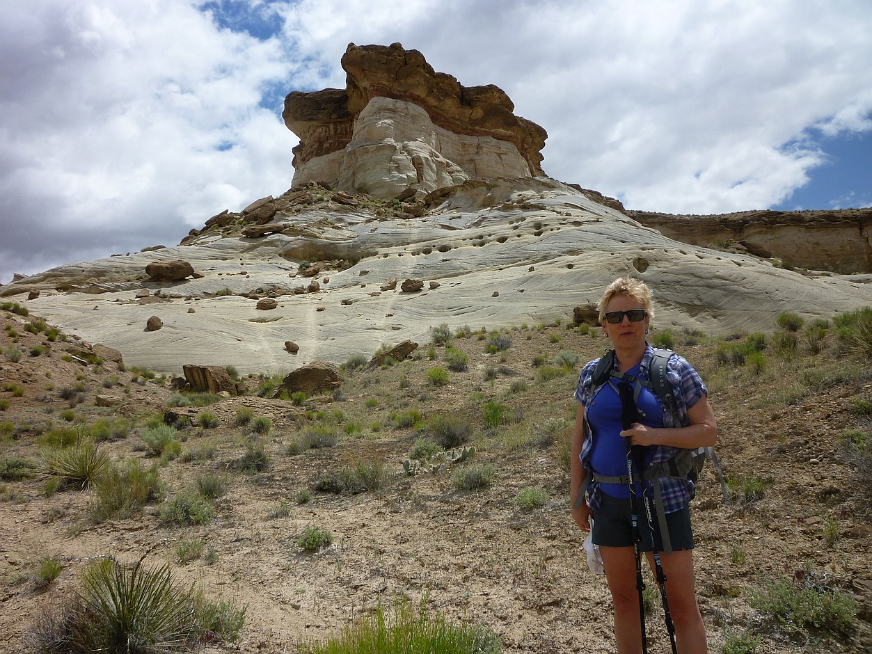
Last year, I had used our upcoming fall cycling trip to the hilly Dalmatian Islands as my kedge, and the thought of those climbs got me out riding our local hills on many a summer’s day.

This year, I elected to participate in a late-August two-day bicycle ride to raise funds for cancer research. However, the real fun began when I elected the optional “challenge” route of 290 km (180 miles.) The longer Day One would be close to double the longest ride I’d ever done.

As I started my training rides, I soon realized that my trusty hybrid cycle was not up to the task. At a top average speed of perhaps 22 kph, I’d be at risk of not finishing before dark. I also wanted to join the local road-riding club for extra weekly motivation, and they had a “no hybrids” policy. So, in April, I acquired an entry-level road bike, the first since my 20s. Shortly after that, I persuaded myself to try “clipless pedals” – so called because the cyclist’s shoes are clipped into the pedals – go figure!

As anyone who’s had their feet attached to the pedals can tell you, a few slow-motion falls are to be expected, especially on days with high cross winds. It hurts a lot less if you land on flat ground rather than a roadside planter. Ouch!

Trying out the new "clipless" pedals

Trying out the new “clipless” pedals

As spring headed towards summer and I worked my way towards 225 km a week, I inched my average ride speed from 22 to 24, then 25, and finally 27 kph. That was the point I’d told myself I’d be ready to join my first group ride. An informal ride was advertised for Tuesday morning: “Pensioners’ Easy Ride.” That sounded good.

I arrived at the meeting point with a slightly bloodied knee – remember those cross winds? The collection of sleek carbon-fiber machines looked intimidating, and some of those “pensioners” must have taken very early retirement. For 20 km, I managed to keep them in sight – although it nearly cost me a lung – after which, they disappeared from view. At the end-of-route coffee stop, they gently suggested the “other” club might be closer to my speed.

Towards the end of the summer, I did manage to get out with the “other” club a few times, and while the rides kept me moving, I was able to hold my own. Good thing! I had my hands full learning the hand signals and other techniques for riding in close formation. This was a very different style of riding than what we do in our recreational club, and I came back from a few “white knuckle” rides with aching fingers.

Fellow riders on the bike trail into Cascade Locks, OR

Fellow riders on the bike trail into Cascade Locks, OR

Meanwhile, our recreational club kept Cheryl and me busy this summer with a number of great rides including a three-day circuit of Oregon’s Columbia Gorge, a multi-day exploration of the BC wine country around Oliver, and a couple days of riding on Washington’s Whidbey and BC’s Pender Island. I knew my training was starting to have an effect when fellow riders remarked on how my hill climbing had improved, and sometimes complained that my “easy” pace seemed to be quickening.

Despite all this, by August I was growing concerned that I still hadn’t proven to my own satisfaction that I could do the ride at month end. So I pushed myself to do longer rides, and ten days ago, I completed my longest ride ever. Although I was still only at 75 percent of Day One, I knew I still had the reserves to do that last 25 percent — and before sunset to boot. Not a moment too soon, as our training advisors soon told us it was time to taper down for event day.

Now, with the ride only a few days off, the kedge has done its work. It got me out cycling on the days I otherwise wouldn’t: when it was too hot, or sprinkling, or when my road bike needed repairs and I needed to take my hybrid. It got me out earlier, later, and longer. My attitude towards hills shifted from “OK, if I have to” to “Bring’ em on – I need the practice!” A 70-km cycle went from being a full-day’s outing to a shorter morning ride.

Cycling Friends, on the ferry to Lummi Is, WA

Cycling Friends, on the ferry to Lummi Is, WA

It got me trying new things such as close-formation riding on a new type of bicycle. I met a whole new set of people I wouldn’t have found otherwise. And it kept me focused on my goal while dealing with a number of mechanical problems such as bent derailleurs, broken spokes, and the need to replace a wheel. And ergonomic problems – I had to hire a bike fitter to implement the recommendations of my physiotherapist. It’s definitely helped my fitness, including loosening a couple of joints that had been over-tight since last October.

This particular kedge has also done something else. It’s allowed me to raise several thousand dollars towards cancer research. For many riders, the fundraising part is the hardest – and many struggle with it. In my case, a number of generous friends, associates, and family members made the job painless. All I had to do was keep them entertained with my painful cycling pratfalls.

Taking a break from cycling on Pender Island, BC

Taking a break from cycling on Pender Island, BC

With only a few days left, I’m looking forward to my weekend ride – forecasts of showers notwithstanding – and already wondering what my next kedge will be. While Cheryl and I plan a 400-km cycling trip in Vietnam early next year, it doesn’t seem solid enough for the purpose. So, I’ll have to come with something else. Stay tuned. I’m off for an evening training ride.

What experience have you had with your own kedges?

Related Posts:

For More Information

Hiking “The Wave” in Arizona

(See Part One of this adventure here.)

Lucky 13

The unfortunate have filed from the lottery room leaving the winners to celebrate.

Having yesterday won the right for today’s hike into “The Wave”, we awoke still lauding our good fortune. From yesterday’s misstep, we could see how easy it would be to get lost for a few hours on a hot afternoon, and run out of water. People die on this hike. Taking the ranger’s advice to heart, we had the “10 essentials,” including almost a gallon of water each, a compass, and a couple of copies of the BLM map. The map shows compass bearings at half a dozen points along the way, as well as photographs taken from each point. Much of the path is unmarked and over bare rock, so it’s important to navigate by the suggested landmarks. Along the way, the route passes from Utah into Arizona, but there’s no sign marking the border.

The Wave Trailhead

Near the trailhead en route to The Wave.  They can always find me from the air with that shirt!

We had a nine AM start from the parking lot that served the North Coyote Buttes. The May air was still brisk, but the sun was already hot. The directions were good, and we had little trouble staying on target for “The Wave”, about 90 minutes distant. From most of the high points along the route, you can see the distinctive cleft in the rocks above the destination. During wetter times, this cleft is apparently a waterfall. It didn’t hurt that Darcy had been there five years before – Marty had unfortunately been Number 11 that day.

Route to The Wave

This is what much of the route to The Wave looks like.

The desert landscape is surreal. The colors of the hills range through every shade of red, yellow and brown. The shapes are equally striking: one set of hills resembled either a row of giant Hershey’s Kisses or perhaps mega-dinosaur coprolites. Although we didn’t see any, there are signs of dinosaurs in the Jurassic era rocks. Looking down, we could see hundreds of fossils; they resemble ancient brain corals, but are probably be something else entirely. In the few areas they could get a foothold, wildflowers were in bloom in pink, yellow, and lavender.

Wild Lavender

Wild lavender grows in a patch of sand showing tracks from the past day or two’s hikes.  The wind will erase them.

Suddenly, we were there.

Arriving at The Wave

Suddenly, without warning, we’re at the entrance to The Wave.

It’s impossible to do “The Wave” justice with either words or pictures. Being in the middle of it is magical. It’s a small smooth-sided twisty gully with undulating stripes of shades of yellow and ochre. By leaving early, we arrived at “The Wave” before the majority of the day’s twenty hikers. Of this we were glad, as being there alone enhanced the visual experience. By the time we left, there were about a dozen people wandering around the area, and it felt almost crowded. But there was a certain camaraderie amongst the lucky few allowed in.

Cheryl in The Wave

Cheryl stands in one of the side channels to The Wave’s main gully.

After eating a quiet lunch while taking in The View – eyed by a cautious raven – we spent an hour or so exploring the area above “The Wave”. While not as stunning as the gully itself, there are plenty of interesting features within a few hundred yards. We were surprised to see a number of small pools of water nearby, and even more surprised to see they were teaming with tadpoles, insect larva, fairy shrimp, and even a few small fishes. We could only imagine that the water table below the now-dry waterfall was sufficiently near the surface to prevent the ponds drying up within hours in the hot sun.

Standing water near The Wave

Teaming with life, a pool of standing water just above The Wave.  The water is very likely brine.

This water is apparently a remnant of the history of the formation. The gully was originally carved out by streams that cascaded down from the cliffs above, but in more recent time, the watercourse has shifted, and the gully has been sculpted by the prevailing winds. During our lunch, there was a good breeze blowing through it. The layered rocks themselves are sandstone laid down over 150 million years ago. At that time, this area was the center of an enormous equatorial desert of reddish sand. Much later, water leaching through the rocks would sometimes bleach iron from alternate layers, resulting in the dramatic stripes.

Proof for Posterity

Our companions and we standing in the main part of The Wave.

Heading back required a similar process using waypoints and compass bearings. The BLM map included photographs and readings for the return journey as well. One would think that retracing one’s steps would be easy, but it’s good not to get too cocky when close to home. The ranger had told us yesterday that more people got off the path on the return journey, especially where the path veers left to go over the saddle near the end of Coyote Buttes. Veering too soon could lead us into a steeper descent than we’d like. Veering too late could have us down in the lowlands where it would be harder to orient ourselves. Or even lead us to the sheer edge of Buckskin Gulch, which would present challenges of its own.

Trekking back from The Wave

Beginning the trek back from The Wave, distracted by visions of cold beer and nachos at Escobar’s.

Sure enough, as we headed up the hill, we began to disagree about the exact route. It’s interesting to see how the brain starts to see patterns and resemblances wherever it looks, and soon each of us was sure of the correct saddle – except there were at least three of them. Soon, two other couples caught up to us and added to the disagreement. I was quite convinced we had gone past the correct saddle, while others thought we needed to go farther still. Six of us eventually continued up the route we were following, and the other two opted for another route. None of us were too concerned about getting lost as we could see the large limestone hills that we knew to be behind the parking lot. Still we knew we could easily spend a couple of hours wandering around in the growing heat.

Death in the Desert

A reminder that not everyone survives out here in the desert.

As we came down the other side, it was clear we had not returned by the same saddle we’d come up. However, by following to the left the small wash at the base of the hill, we soon got back to the trail, which is clear enough at that point. The rest of the trip back to the car was uneventful. But even in hindsight, I doubt we four could all agree on exactly by which route we’d returned.

Flowers in the Sand

Away from the bare rock, more desert flowers blooming in mid-May.

As we left the parking lot, we passed the ranger coming in for the afternoon. Since each car needs to display a copy of its permit, there would be a good indication of who had not returned by nightfall, and in what area they would be. So if you get lost, someone might come looking. However, if you don’t feel comfortable with that possibility, it’s recommended to hire a guide for the hike. And take lots of water.

Celebrating our Luck

Celebrating our luck in winning the chance to hike into The Wave in Arizona.

At the end of the day, we still felt incredibly lucky to have won the lottery to visit “The Wave.” With our chances having been about one in twenty, we hadn’t really expected this outcome. We heard a rumour that if you fail to win a spot, and return to try again each subsequent day, you will be awarded an additional ball each day, up to a maximum of five balls. That would probably give you a fifty-fifty chance of getting in by the fifth day. However, I was not able to find a reference to this online. Another option is to enter the online lottery for one of the other ten spots, something you need to do several months in advance. Good luck!

Cheryl and the Terrain

Cheryl posing in front of the unforgiving terrain that guards The Wave.

On the way back through Las Vegas airport, I finally got to try my luck at the slot machines. Gambled and lost a dollar and that was enough for me! I guess I’d used up all my luck in Kanab.

Notes in the Margin:

A few days before our trip, we received an unusual request through the Couchsurfing site. A young couple in Poland were getting married, and the bride’s brother was creating a video with best wishes from all over the world. We offered to send our greetings from our home town, but thought it would be a nice touch to send personal greetings from Zion and “The Wave” as well. So we had some extra fun putting those together on the hikes.

Unlucky Seven

What?! I knew I should have bet on 13.

Related Posts:

For More Information:

Bye for Now!

Waving from The Wave – all the way to a Polish wedding!

Lucky 13 Wins in Vegas, … er, … Kanab, Utah

We didn’t win in Las Vegas, but we came up lucky while hiking in Utah.

Friends Darcy and Marty had planned a return visit to some of the areas they’d visited years before, and asked us to come along. Since Cheryl had no new contracts pending, we took up their offer at the last minute; one of the perks of the “No Pension Will Travel” lifestyle.

From Observation Point

The expected view from our first destination.

We flew discount airline Allegiant from Bellingham to Las Vegas. Their prices are low, but watch those extras. The default seating arrangement appears to ensure that couples are not together, and there’s an “upgrade” charge to move even one seat over. The rumoured fee to use the toilet was hyperbole.

We arrived in Vegas in the late evening, giving us just enough time for a driving tour of The Strip. This was mainly for my benefit, as the other three had each been to Vegas several times before. I remarked how much Las Vegas resembled a “Disneyland for Adults.” However, I missed my chance to thwart the one-armed bandits; early next day, we headed out for the three-hour drive to Kanab, Utah, planning a stop in Zion National Park for a hike up to Observation Point.

Observation Point

Part way up, Cheryl contemplates the remainder of the ascent to Observation Point.

I’d been wondering what Darcy had in store for us. About my age (and just as young looking), Darcy had recently run the Boston Marathon, and won her age group in a local half-marathon. She isn’t known for shirking a challenge. As a less experienced hiker, I thought I’d check out some of the hazards of hiking in Utah. Rattlesnakes, perhaps? Yes, there are some, but some of the biggest dangers are falls, dehydration, and flash floods. All can be mitigated with careful planning. And, as with most travel, driving is probably the top risk.

Observation Point climb

Much of the ascent to Observation Point looks like this.

I did see that Angels Landing in Zion had made it onto at least one list of “20 Most Dangerous Hikes.” Then I learned that Darcy had done that hike last time. “Observation Point is easy by comparison,” she said, although I wondered about “easy by comparison.” It’s an eight-mile round trip, with 2100 feet of elevation gain, the endpoint looking down on Angels Landing. The footing is smooth, making it doable if you’re used to those kinds of distances; we made the return journey in well under the suggested time of five hours.

Wildflowers in Zion

May was a great time to see wildflowers on all four of our Utah hikes.

This was Cheryl’s first hike since recovering from a running injury, so she was monitoring her body’s reactions to the climb and descent. Happy to say, it went well, although her legs complained to her the next day about the shock therapy.

Happy on Observation Point

Happy on Observation Point

I’m prone to vertigo – it’s a family trait – and there was about 20 minutes of uphill and about 45 on the return, when I found myself hugging the cliff side. The ledge was probably four or five feet wide at this point; most people wouldn’t be bothered. Still, I kept a watchful eye on the weather. I wouldn’t have enjoyed coming down during a blustery rain storm, and the rangers were divided on whether it would rain again before it cleared that evening. Lucky for us, the clouds began to lift, and we had only expansive views to contend with.

Hey, where's the lunch?

This little guy joined us for lunch. We also saw mule deer and wild turkeys in Zion.

Our home base in Kanab was the funky Parry Lodge, on the National Register of Historic Places. The rooms and lobby are plastered with photos of the many stars who came here to film westerns, mostly from the 30s through the 60s. With reasonable prices – about half of those charged in other areas around Zion – the Lodge was fully booked every night. The service was friendly, and even included packing us five-dollar box lunches that were big enough to share. It’s a busy kitchen, so if you have special dietary requirements for your hike, it’s best to write them out beforehand.

Heading down from the Point

Watching our step, heading down from Observation Point.

The next morning, we headed over to the BLM office in Kanab to do some gambling. We really wanted to do the hike into “The Wave”, in the North Coyote Buttes which straddle the Utah-Arizona border. It’s a popular destination, but permits are limited to 20 people a day. Ten of those are awarded via a lottery the day before. With about 200 people a day applying, our odds weren’t good. Our backup plan was to do a hike in Bryce Canyon. On this day, about 45 separate parties entered the draw, from as far away as Germany, China, Saudi Arabia, and Australia. The ranger read out the

Late afternoon sun in Zion

Late afternoon sun illuminates a peak in Zion.

names, origins, and ball assignments. I wished aloud for my lucky number, 13, and we thought it a good omen when we were assigned that ball. The packed hall fell silent as the hopper was spun. I wondered what we’d do if we only won spots for half our party, but Cheryl refused to speculate. Then, the first ball out was lucky 13 and we whooped and hollered like Vegas winners. The ten chosen hikers stayed behind to get maps and detailed instructions on how to find “The Wave” tomorrow. We learned that hikers occasionally failed to find it, and many get off the trail while returning. So, listen up!

Fording Wahweap Wash

These campers returned the next day to find Wahweap Wash dry no more.

For today, with flash floods possible, we decided to avoid Buckskin Gulch, and instead headed out for Wahweap Hoodoos near the tiny town of Bigwater. There we were reminded of the need to stay vigilant. Leaving the parking lot, and crossing Wahweap Wash – now running with snow melt from Bryce Canyon – we thought the instructions and trail map straightforward. But as the morning wore on, we began to wonder if we’d made a wrong turn. Eventually, we reached an abrupt end of the wash – and no hoodoos in sight. Turning around and retracing our steps, we spent much of the time speculating on various places we might have made a wrong turn. We had a good laugh, when, about 100 yards from the trailhead, we saw the signs we’d missed directing hikers up Wahweap Wash. We had, instead, gone up Nipple Creek. It was a good lesson for tomorrow if we weren’t also to miss “The Wave.”

Hoodoo-like Peak near Wahweap

This hoodoo-like peak is as close as we got to the Wahweap Hoodoos.

We consoled ourselves with a stop at the Toadstool Hoodoos, an easy few minutes from the highway. Marty thought there were fewer hoodoos at Toadstool than he’d remembered, and we speculated on whether erosion or human agents were to blame. We later learned there has been vandalism in some of Utah’s hoodoo sites. What a shame!

Toadstool Hoodoos Trail

The approach to Toadstool Hoodoos was picturesque.

We dined that evening at Escobar’s Mexican Restaurant, where copious good food is served with ample good cheer. It’s a small place, and popular, so waits are likely. Bellies stuffed, we returned to Parry’s Lodge to dream of “The Wave” – with the occasional nightmare about failing to find it.

Toadstool Hoodoo

One of the Toadstool Hoodoos looks precarious.

Next up: Hiking “The Wave”

Related Posts:

Wildflowers in the Wash

With so much to see, it was hard to remember to look down, but there were flowers everywhere.

For more information:

Everything in bloom

Almost everything seemed to be in bloom.

Adventures in Our Back Yard

“Hey, this isn’t so bad!”

It was our first hike in our second season with the local outdoor club, and we’d just made it up to the top of a pretty big hill.  A mountain, in my lexicon.  (Technically, it was our second hike of the year, but we didn’t think the popular New Year’s Day “hangover hike” counted.)  Coming back down proved to be our undoing.  We limped around the house for three days, helping each other up the stairs.  By the next weekend, however, we were ready to try a higher peak.

The 'higher peak', seen from the 3/4 point

The ‘higher peak’, seen from the 3/4 point

Joining a local outdoor club was another of the fortunate steps we’ve taken lately as we try to replace our dwindling old communities … with surprising benefits.  Cheryl and I had been casual hikers, casual cyclists, and infrequent paddlers for years.  Fair-weather adventurers.  Our last camping experience – when the boys were young – had us wrap up the soggy tent after three days of rain, and buy a last minute special to Mexico.  We thought of ourselves as reasonably fit … “for our age.”

We did like to get out for shorter hikes with a few friends.  Now the years were taking their toll on our circle – with injuries, operations, and just plain lethargy.  At times, we couldn’t find a single person to accompany us on a weekend hike.

With some trepidation, we found and joined a local Outdoor Association and booked ourselves on one of their upcoming outings.  We fully expected to be the “slowpoke seniors” in a group full of energetic youths.

Hikers at Windy Ridge, overlooking the Mt. St. Helens crater

Hikers at Windy Ridge, overlooking the Mt. St. Helens crater

Much to our surprise, we found ourselves among the youngest on the trip – although it took us a few hikes to get past the “slowpoke” part.  As we’ve continued to do hikes and bike trips with members of the group, we’ve met close to 100 of the 250 members, and almost all of them are our age or older.

So many of these hikers and cyclists are inspirations!  It’s quite something to spend six or seven hours hiking up and down mountain terrain only to discover the septuagenarian we’ve been struggling to keep up with has two titanium hips or knees.  The senior hard on my heels has just done her 100th marathon.  Some members in our club, often retired for decades, have medical conditions that would keep most people chained to their easy chair – instead, they’re using a bit of chain to get past a few feet of scree on a mountainside.

A club cycle ride usually has 10 to 20 participants

A club cycle ride usually has 10 to 20 participants

So we’ve been inspired!  We’ve done a number of hikes we would never have done on our own.  We cycle 40 miles or more on a Saturday ride without giving it a second thought.  We’ve been camping again – so far just tailgate camping, with folding cots in the tent.

The surprise was how we fell into a new community of people in our stage of life, either retired or contemplating retirement.  Not a retirement of slowing down – instead, one of taking on new challenges and adventures.  Many we’ve met share our passion for “back roads” travel, and many of those have found creative ways to finance their lifestyle.

We’ve also been reintroduced to travel in our own part of the world.  In search of new horizons, volunteers in the club have put together multiday hiking or biking adventures in locations from the Mexican border to Alaska – plus the occasional one overseas.  Much as we’ll continue to visit other continents, we now foresee more travel close to home.

A happy wanderer, overlooking the North Cascades

A happy wanderer, overlooking the North Cascades

We’re also seeing that we won’t have to settle for being “slowpoke seniors” – we’ve got lots of counter-examples all around us, and we’re starting to catch up.  At this year’s “summer camp,” Paul read over “Younger Next Year,” and has started this program, using the burst of summer hiking as the “kedge” to jump-start his program.  Today, we head out to a four-day kayak camp.

For next year, we’re looking for a hike or cycle route that we’d feel confident leading.  That would be a first for us.  We’ve also found a some members who are interested in joining us on our next year’s European bike trip: a solution to the dilemma posed by our Provence trip earlier this year.

Exploring Mt. St. Helens beyond the Visitor Center

Exploring Mt. St. Helens beyond the Visitor Center

What can you do if you want to find a similar group to get you moving instead of slowing down with each passing year?  There are many options, but it may depend where you live.  We have no idea whether other outdoor clubs tend towards an older membership – ours didn’t advertise the fact.  The club is 40 years old and perhaps the membership has aged with it.  Still, retired people often have more time for such pursuits, and a stronger sense of “use it or lose it.”

We found our group by doing Internet searches for “hiking club” and the like.  It turns out there were quite a few in our City, including special interest groups like “dog-friendly hikers.”  We picked ours primarily based on the region it served.  We’ve since discovered that many members belong to more than one group, so finding one quickly leads to others.  Many states and provinces have umbrella associations for various outdoor groups, and often publish directories.

The view from the top always makes it worth the slog

The view from the top always makes it worth the slog

Another way to locate groups for outdoor activities is though Meetup.com (which we wrote about in our last post.)  In our experience, the Meetup groups tend to be looser, and some members are frustrated with a lackadaisical attitude towards event planning.  (Our own club is well organized, with a full executive, plus sub-committees for hiking, cycling, snowshoeing, and paddling.  Experienced members volunteer to plan and lead individual events, while newcomers learn the ropes.)

However you do it, joining an enthusiast group of active hikers or cyclists will get you out there when you just “don’t wanna.”  Try it out.  And see you on the mountain!

“Do not go gentle into that good night,
Old age should burn and rave at close of day;
Rage, rage against the dying of the light.”
Dylan Thomas (1914-1953)